Master Planning & Design
PlanScapes expertise is in Master Planning for the acquisition, use and disposition of real estate.The combination of site and building construction, municipal and private planning and years of real estate valuation and acquisitions places PlanScapes in a unique position to develop master plans and strategies for locating properties for grocery stores, convenient stores with petrol service islands, highway billboard locations, truck service centers and rail depots, other various commercial uses, resort and housing developments as well as alternative energy and telecommunication sourcing.
Stormwater Management Planning

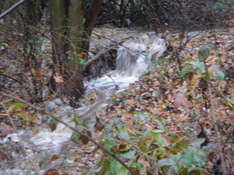
PlanScapes expertise is also in envisioning the best management practice for rainwater enhancement and management systems that attempt to closely mimic the natural rainwater system and absorption process. This is accomplished by understanding the natural drainage characteristics of a given site and mapping those features. This process can be used on individual properties to regional watershed management planning. Initially, target areas are identified for rainwater collection, treatment, storage, recharge to ultimate downstream discharge. Thereafter, various methods to enhance water quality, encourage groundwater replenishment and protect natural waterways downstream can be planned for and designed into a comprehensive rain water management system.
Our rainwater conservation systems include the collection of roof and other surface drainage from homes and properties into rain barrels, cisterns, wells and rain gardens and from streets and driveways into bio-retention ponds and forebays in existing stormwater management basins or in alternative treatment and infiltration areas. Some of the downspout water can then be used to water the garden or flower pots. The rain-gardens can be used for bird and butterfly habitat and act as a significant landscape feature. The water collection basins incorporate pretreatment areas like forebays and infiltration meadows linked to wet/dry storage ponds with outflows incorporating secondary treatment using infiltration/vegetated swales before entering the natural waterway.
The overall objective of PlanScapes rainwater conservation designs are to minimize rainwater runoff as a means to capture and replenish the groundwater supply associated with the home or neighborhood who's households usually obtain their drinking water from on-lot wells. These systems also help reduce erosion and downstream sedimentation from entering into the natural waterways, brooks, creeks and streams which helps improve overall water quality for everyone.
Neighborhood Planning & Design

PlanScapes proprietor is licensed in the state of New Jersey and is nationally certified to prepare land use and master plans from individual properties and neighborhoods to town-wide and regional resource planning. Years of construction experience and 15 years as vice president of land planning & acquisitions for one of the leading builders of luxury homes in America today rounds out his expertise. This comprehensive expertise provides PlanScapes with the ground up knowledge needed to effectively plan, design and entitle properties to naturally blend with their surroundings while promoting a sense of style, comfort and lasting value. A main component of our land planning program is to coordinate and obtain governmental approvals and entitlements for new projects. With our comprehensive knowledge of the design, approval and ultimate land use and development process we are generally able to obtain a more environmentally sensitive and marketable project while reducing the overall cost of the entitlement process compared to a typical less managed project.
Municipal Master Planning
Master Park, Open Space & Resource Plan

This plan was developed to assess and assure that this growing township identified and adequately planned for its future park, recreation and open space needs. This plan prepared a detailed inventory of all park and recreational opportunities currently provided in the many villages within the township and related those facilities to their associated user group populations. Once identified, a graphic matrix was developed to visualize facility supply and relative current and future needs which varied by individual planning area. Also the general demographic composition of each village was analyzed to determine the best mix of appropriate park and recreation facilities from tot lot in younger family neighborhoods to more passive opportunities in those neighborhoods with an aging population. In addition, community-wide natural resources like scenic and environmentally sensitive open space resources such as a number of abandoned water filled quarries were linked with other community-wide recreational facilities and uses. This plan also established a rational nexus for the imposition of park and recreation impact fees for all new development within the township to be used to help fund the identified future park, open space and recreation goals of the plan.
Building Re-Use and Space Planning

THE ALPHA BUILDING
This Plan viewed one of the most significant historic building located on the town square in center city. The building was originally build by the cement company that the adjoining town was named for and which had been vacant for many years. This plan evaluated the need to re-establish commerce and housing in the city's core which was now easily accessible from a recently completed interstate highway.
After evaluating the perceived needs of the city, a mixed-use plan for the building was developed proposing that the main tenant would be the city with the relocation of their city offices from a location outside the downtown area. The plan for the first floor was to construct a new mezzanine level to create an interesting and inviting main retail and visitors center at street level. The city was expected to occupy the middle floors with direct access to the adjacent city parking garage at the third floor by means of a sky-bridge over Pine Street. Above the city offices would be residential condo's with a private access to the building and private elevator to their floors from the main side entry at street level. All of these use types would bring people back to center city which is a fundamental program requirement of the plan.
Web Hosting by iPage


